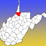
[dropcap]T[/dropcap]he chart below is part of what I have been working on that has taken me from blogging. I have been chart crazy lately. This is the start of my GPS/UTM chart for Wetzel County, West Virginia. The entries below are for Center District. I went into Google Drive and made a spreadsheet for Wetzel County, giving each district a tab. I am excited about this project.
 If this experiment goes well I will be making a spreadsheet for all of the counties I research heavily in. I know this is a little OCD but I have found it very useful in getting a different perspective on my family history. My next major step is to make a map of the locations I have mapped out in Adobe and have Photoshop layers for plat maps, historic land changes and more. This will give me an opportunity to see beyond just GPS/UTM or plat maps. I hope someone finds this article helpful. If this inspires you to map out your family this way or in another way let me know in the comments below!
Center District, Wetzel County, West Virginia, USA
| Name | Place Type | Notes | AKA | GPS |
| Anthem | Community | Unincorporated | Lat 39.6467497 Lon -80.5284176 | |
| Dean | Community | Lat 39.6495262 Lon -80.5900872 | ||
| Delaney | Community | Lat 39.6348035 Lon -80.6295343 | ||
| Endicott | Community | Endicot | Lat 39.6781373 Lon -80.5836963 | |
| Hoyt | Community | Lat 39.6128591 Lon -80.6367581 | ||
| Knob Fork | Community | Unincorporated | Geaneytown, Joliff, Joliffe, Jolliffes Store, Knobford, Knobfork Store, Sugar Run | Lat 39.6486938 Lon -80.5467517 |
| Kodol | Community | Unincorporated | Lat 39.6228608 Lon -80.5406418 | |
| Onie | Community | Ghost Town | Unie | Lat 39.37110 Lon -80.37510 |
| Rockport | Community | Unincorporated | Lat 39.7075815 Lon -80.5811945 | |
| Silver Hill | Community | Unincorporated | Silverhill | Lat 39.6931362 Lon -80.6311978 |
| Suter | Community | Ghost Town | Lat 39.618692 Lon 80.651203 | |
| Uniontown | Community | Lat 39.633684 Lon -80.558239 | ||
| Wheat | Community | Dakon, Little Creek | Lat 39.6264709 Lon -80.5948109 | |
| Wileyville | Community | Unincorporated, Former County Seat | Lat 39.6306361 Lon -80.6734256 | |
| Shuman Lands | Family | Carl Bryan Shuman and Ancestors | Lat 39.6175901 Lon -80.6498533 | |
| Sapp House | Family | Ollie and Maxine Sapp | Lat 39.6213388 Lon -80.6164238 | |
| Sapp Farm | Family | Aunt Tersie and Ancestors | Lat 39.6473487 Lon -80.5476422 | |
| Peggy | Family | “Aunt” Peggy | Lat 39.6259094 Lon -80.658038 | |
| Clarence Dean | Family | SPO Irene Cain | Lat 39.624518 Lon -80.610071 | |
| Long Valley Baptist Church | Church | Lat 39.6254174 Lon -80.6071538 | ||
| Long Valley Church of Christ | Church | Lat 39.6275221 Lon -80.6011259 | ||
| Potts Cemetery | Cemetery | Long Valley Cemetery | Lat 39.6276835 Lon -80.6001959 | |
| Shuman School | School | Historical | Lat 39.6209144 Lon -80.6439803 | |
